 |
| 
|
A Drive north of Brampton
A short tour round the Forks of the Credit, Caledon
going through Belfountain, Cataract and Inglewood
circa 65 km; 1.5 hours driving;
Please obey all current Covid-19 regulations
Begin at the north end of Hwy 410 where it merges with Hwy 10
You are north of Brampton
Drive north on Hwy 10 for 1.6 km
1 Turn left (west) onto Old School Road
2 Turn right (north) onto McLaughlin Rd
- pass on right Great War Flying Museum' www.greatwarflyingmuseum.com
- cross King St
- cross Boston Mills Rd
3 Turn left (west) onto Olde Base Line
- cross Chinguacousy Rd
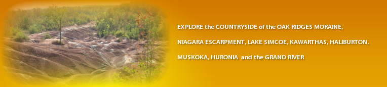
- pass on left the Badlands
- cross Creditview Rd
4 Turn right (north) onto Mississauga Rd
- pass on left Melville White Church (historic)
- cross The Grange Side Rd
enter hamlet of Belfountain
- pass on left Bush St (at centre of hamlet)
our route curves to the right (east)
- pass on right ice cream parlour
- pass on right entrance to Belfountain Conservation Area
our route is now Forks of the Credit Rd
- pass on right Scott Dr
5 pass on left Mississauga Rd
our route drops down to a hairpin bend (caution)
- pass under railway bridge
- pass on left Dominion St (which crosses a bridge over the Credit River)
Help Hint - if you park by the roadside and walk to stand on the bridge, you will see the joining of the two branches of the Credit River which gives the place its name.
6 Turn left (north) onto McLaren Rd
- pass on left Puckering Lane
- pass on left entrance to Forks of the Credit Provincial Park
Help-hint - good hiking and historical ruins in the Park
7 Turn left (west) onto RR 124 (Charleston SR)
- pass on left a parking spot before crossing the Credit River.
8 Turn left (south) onto Main St
Help Hint - gas station and restaurant on corner
our route curves right ... at the Forks of the Credit Inn in hamlet of Cataract
our route is now Cataract Rd
winding road
- cross Elora-Cataract Trailway (former railway, now a multi-use trail)
Help Hint - no parking at this point, use the Provincial Park for access
9 Turn left (south) onto Mississauga Rd
winding road by ski hills
10 Turn left (east) onto Forks of the Credit Rd.
Help Hint - 10 to 11 is a repeat of the route from 5 to 6
our route drops down to a hairpin bend (caution)
- pass under railway bridge
- pass on left Dominion St (which crosses a bridge over the Credit River)
Help Hint - if you park by the roadside and walk to stand on the bridge, you will see the joining of the two branches of the Credit River which gives the place its name.
11 pass on left McLaren Rd.
12 Turn right (south) onto McLaughlin Rd
- cross The Grange SR
- pass through hamlet of Inglewood
Help Hint - from Inglewood, there is a pleasant walk (east) along the Caledon Trailway to Hwy 10 and Ken Whillans CA
13 Turn left (east) onto Olde Base Line
- cross Hwy 10
- cross Kennedy Rd
14 Turn right (south) onto Heart Lake Rd
- cross Boston Mills Rd
- cross King St
- pass on right Downeys Farm Market www.downeysfarm.com
15 Turn right (west) onto Old School Rd
- cross Kennedy Rd
- arrive at Hwy 10 and the end of the tour
16 Turn left (south) to return to Toronto by Hwy 410
 |